NASA's new map shows Mexico City sinking faster than anyone realized
NASA satellite reveals Mexico City is sinking unevenly, with some areas dropping 2cm monthly due to groundwater depletion.
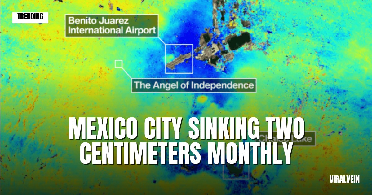
Mexico City has a problem that's literally pulling it under. A new NASA map shows the city isn't sinking evenly — some neighborhoods are dropping up to 2 centimeters every single month. That's far faster than experts expected.
The satellite data reveals a patchy, uneven collapse happening beneath the sprawling metropolis. Some areas stay relatively stable while others crater at alarming rates. It's a bit like watching a building settle unevenly on bad foundation soil, except this is a city of 21 million people.
The cause is groundwater extraction. Mexico City sits on a former lakebed, and for decades the city's been pumping water out of the ground faster than it refills naturally. Once you pull the water out, the soil compacts. It doesn't bounce back. And unlike other sinking cities, Mexico City's collapse is wildly uneven because water pumping isn't uniform across the city.
The NASA data gives authorities their clearest picture yet of where the sinking is worst. Some central neighborhoods have sunk several meters over the past century. Infrastructure cracks. Subway tunnels warp. Sewage systems back up. Building foundations tilt. (Yeah, all of it, at once.)
The city's already trying to fix things — importing water from neighboring regions, restricting new wells, pushing water recycling. But reversing decades of over-extraction isn't happening overnight. Mexico City's infrastructure was built on a sinking foundation, and now everyone's scrambling to keep up.